|
|
|
|
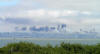
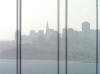
A typical view of San Francisco's skyline
|
|
|
|
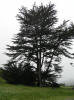
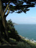
Point Reyes National Seashore was fogged in too, but still had cool trees
|
|
|
|
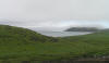
There's an ocean out there somewhere.
|
|
|
|
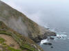
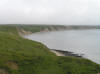
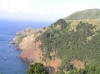
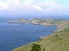
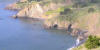
Still an impressive coast
|
|
|
|
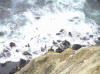
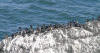
Seals in the surf
|
|
|
|
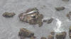
Seals on the rocks
|
|
|
|
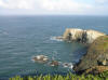
Bluffs
|
|
|
|
|
|
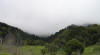
Fog devouring the hills
|
|
|
|
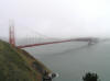
Golden Gate Bridge in its shroud
|
|
|
|
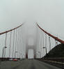
Top half of northern tower gone
|
|
|
|
Southern tower completely gone
|
|
|
|
Caution: see-saw in street?
|
|
|
|
What a difference a day makes.
|
|
|
|
Golden Gate NRA
|
|
|
|
|
|
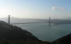
Golden Gate Bridge from the Golden Gate NRA
|
|
|
|
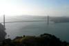
Another angle
|
|
|
|
Lighthouse Point
|
|
|
|
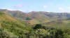
Looking inland at Golden Gate NRA
|
|
|
|
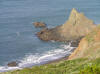
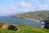
Rugged coast
|
|
|
|
Golden Gate NRA covers more than 75,000 acres
|
|
|
|
A mysterious cave in the cove.
|
|
|
|
|
|
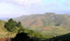
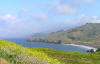
A classic springtime scene
|
|
|
|
Golden Gate NRA has more than 59 miles of shoreline
|
|
|
|
Nobody ever reads these captions
|
|
|
|
Bird Rock, with its "natural decorations"
|
|
|
|
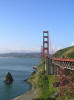
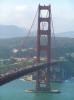
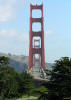
Golden Gate Bridge's towers are 746 feet tall. The span is 220 feet above the water.
|
|
|
|
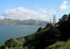
The wide channel of water is actually the "Golden Gate" for which the bridge was named.
|
|
|
|
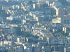
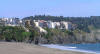
Hillside homes, zoomed in from across the bay
|
|
|
|
|
|
Skyline silhouette with foreground cables
|
|
|
|
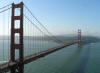
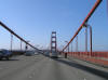
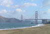
The Golden gate Bridge is 1.7 miles long, and runs north-south
|
|
|
|
The Bridge was finished in 1937. And there was great rejoicing.
|
|
|
|
Ocean view from the Presidio
|
|
|
|
The Marin Headland, from the Presidio
|
|
|
|
The Marin Headland, from the Presidio
|
|
|
|
Cliffhangers
|
|
|
|
|
|
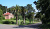
A Presidio street
|
|
|
|
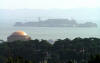
Alcatraz, from the Presidio's overlook
|
|
|
|
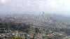
City view from Twin Peaks
|
|
|
|
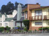
Typical San Francisco homes
|
|
|
|
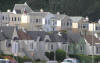
Typical San Francisco homes
|
|
|


