|
|
|
|
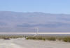
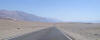
CA-190 East, through Panamint Valley. That 10-mile climb leads to DVNP. You can watch your temperature guage rise with the elevation.
|
|
|
|
|
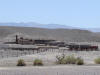
Ruins of a borax mine.
|
|
|
|
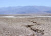
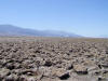
Parched earth.
|
|
|
|
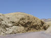
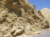
The strange yellow walls of Mustard Canyon.
|
|
|
|
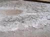
A closer look at the long-dried mud.
|
|
|
|
|
|
Moby, in shot for perspective
|
|
|
|
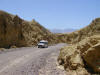
The bleak, gray road, looking back at Mustard Canyon
|
|
|
|
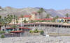
Death Valley Hotel, at sea level.
|
|
|
|
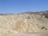
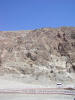
Large, smoothed hills, from Zabriskie Point.
|
|
|
|
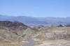
Looking west from Zabriskie Point, a couple hundred feet above sea level.
|
|
|
|
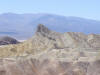
Zabriskie Point
|
|
|
|
|
|
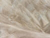
Velvet ground at ZP
|
|
|
|
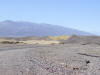
CA-178 south, through Death Valley
|
|
|
|
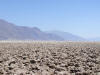
Devils Golf Course, looking northwest
|
|
|
|
Devils Golf Course, facing east
|
|
|
|
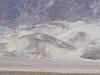
Painted foothills
|
|
|
|
Devils Golf Course, looking south
|
|
|
|
|
|
|
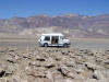
Moby at DGC
|
|
|
|
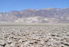
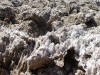
Salt crystals. Not easy to walk on this stuff, and it goes on for miles.
|
|
|
|
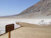
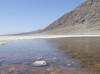
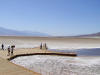
Badwater, the lowest point in the USA: 282 feet below sea level
|
|
|
|
The highly-salinated water is bad for drinking, hence the name.
|
|
|
|
Mud
|
|
|
|
|
|
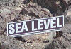
Find this sign in th next photo...
|
|
|
|
"Sea Level" sign is barely visible, 2/3's of the way up that ridge.
|
|
|
|
|
The Badwater boardwalk.
|
|
|
|
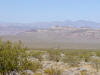
CA-178, heading east into Nevada.
|
|
|


