|
|
|
|
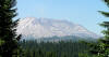
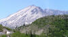
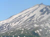
Mount St. Helen's, viewed from about 10 miles to the north.
|
|
|
|
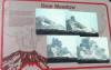
Historical sign, describing the morning of the eruption
|
|
|
|
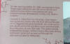
A more readable view
|
|
|
|
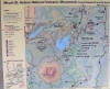
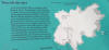
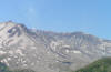
The lay of the land
|
|
|
|
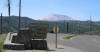
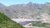
The official entrance to the National Monument.
|
|
|
|
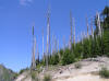
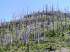
Old skeletons and new-growth forest. It has taken the ground a long time to heal here.
|
|
|
|
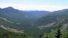
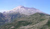
A view to the east
|
|
|
|
|
|
Explanation of the Blast Zone
|
|
|
|
Tree graveyard
|
|
|
|
For miles, whitish-gray trunks of shattered trees litter the hillsides, all facing the same way -- away from the blast
|
|
|
|
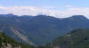
Mount Rainier in the distance to the northeast
|
|

|
|
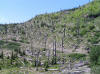
As the road brings you closer to the volcano, the number of dead trees increases
|
|
|
|
Volcanic rock, formed 1000's of years ago
|
|
|
|
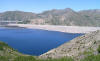
Spirit Lake, about 7 miles from MSH, was a thriving vacation and camping area...
|
|
|
|
|
|
Now, more than a quarter century after the eruption, it remains choked with thousands of dead trees
|
|
|
|
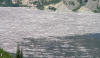
What looks like a wide and light sandy beach....
|
|

|
|
...is a vast logjam
|
|

|
|
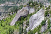
Another hillside, even closer to MSH. The blast knocked all these trees down in seconds.
|
|
|
|
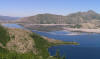
Spirit Lake
|
|
|
|
The east slope of Mount St. Helen's. Note the steam rising from a vent in the caldera.
|
|
|
|
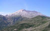
The volcano from 7 miles away. MSH lost 1413 feet of elevation that fateful day.
|
|
|
|
|
|
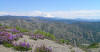
Wildflowers and a long range view to the northeast
|
|
|
|
The caldera still breathes
|
|
|
|
No vegetation has returned to the lava and dust encrusted mountainside
|
|
|
|
No one is allowed within 5 miles of the mountain.
|
|
|
|
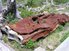
A mechanical victim, melted and crushed. It's unknown what became of the car's owner.
|
|
|


