|
|
|
|
Highway 112, heading west along the north coast of the Olympic peninsula
|
|
|
|
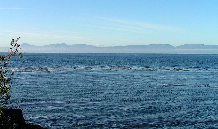
That's Canada over there.
|
|
|
|
WA-112 again, looking back to the east
|
|
|
|
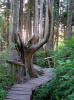
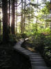
Drive up a long road through deep forests, and you still have about a half-mile hike ahead of you
|
|
|
|
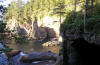
Much of the walkway is this very cool boardwalk constructed by the Makah Indians
|
|
|
|
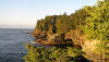
Then, between the trees, you get our first glimpse of the specatacular coast
|
|
|
|
|
|
Having clear skies and brilliant sunshine doesn't hurt
|
|
|
|
Those trees look safe from the lumber industry
|
|
|
|
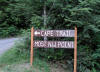
Cape Flattery is on Makah Indian Reservation land. It is not even a State Park.
|
|
|
|
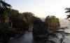
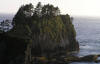
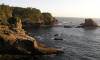
Approaching the end of the walk, you get this view to the north
|
|
|
|
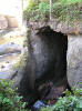
Caves like these have been worn deep by the relentless, wind-driven surf.
|
|
|
|
More caves
|
|
|
|
|
|
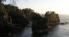
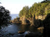
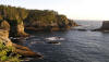
The view to the south
|
|
|
|
|
Canada in the distance, beyond the impressive cliffs
|
|
|
|
Cliffs to the south
|
|
|
|
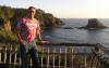
Representing the southernmost city at the northwesternmost point.
|
|
|
|
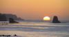
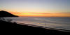
WA-112 on the road back east, looking back a sweet sunset
|
|
|
|
|
|
|
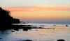
The afterglow
|
|
|
|
|
A sunpillar in the deepening glow
|
|
|
|
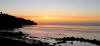
The last glow on the contiguous USA...
|
|
|